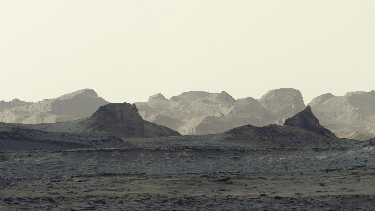
NASA has released a new panorama captured by the Curiosity rover on the slopes of Mount Sharp. The image features yardangs, which are rock formations shaped by long-term wind erosion. Scientists plan to study these structures in detail once the rover reaches the site.
The panorama was taken on August 11, 2026, using the Mastcam instrument. It consists of six frames processed without standard color balancing to preserve the morning light. The shot was captured at 8:30 AM local Martian time, showing blue hues in the foreground and illuminated rock formations on the horizon.
The yardang layer stretches for approximately 16 km along the northwestern slope of the 5 km high Mount Sharp. Curiosity has been climbing the mountain since 2014 and recently reached an altitude of 1 km above the floor of Gale Crater, setting a record for Martian missions.
Mount Sharp contains layered rocks that provide data on the history of Mars. Researchers are investigating whether the current terrain was shaped by wind after water disappeared, with volcanic ash deposits also considered as a potential origin for the yardangs. The rover is expected to reach the base of these formations in 2027 to conduct direct analysis.